- Municipal Borough of Walthamstow
-
Walthamstow Motto: Fellowship is life 
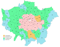
Walthamstow within Essex in 1961Geography Status Civil parish
Urban district (until 1926)
Municipal borough (after 1926)1911 area 4,343 acres (17.58 km2)[1] 1931/1961 area 4,342 acres (17.57 km2)[1] HQ Walthamstow History Created 1894 Abolished 1965 Succeeded by London Borough of Waltham Forest Demography 1911 population
- 1911 density124,580[1]
28.7/acre1931 population
- 1931 density132,972[1]
30.7/acre1961 population
- 1961 density108,845[1]
25.1/acre
Coat of arms of the borough councilWalthamstow was a local government district in south west Essex, England from 1894 to 1965, around the town of Walthamstow. It was within the London suburbs, forming part of the London postal district and Metropolitan Police District. Its former area now corresponds to the central part of the London Borough of Waltham Forest in Greater London.[2]
Contents
Background and formation
The ancient parish of Walthamstow formed part of the Becontree hundred of Essex. It was included in the Metropolitan Police District in 1840. In 1873 the civil parish was constituted an urban sanitary district[3] and under the Local Government Act 1894 it became an urban district.
District and borough
It gained the status of municipal borough in 1926. The borough ran its own tram services until they became the responsibility of the London Passenger Transport Board in 1933.[4]
Walthamstow Town Hall was built on Orford Road in 1876. A new town hall was built in Forest Road in 1941.[5]
Abolition
The Royal Commission on Local Government in Greater London considered the borough for inclusion in Greater London in 1965 and subsequently it was abolished by the London Government Act 1963. Its former area was transferred to Greater London from Essex to be combined with the Municipal Borough of Chingford and the Municipal Borough of Leyton to form the present-day London Borough of Waltham Forest.
References
- ^ a b c d e Vision of Britain - Walthamstow UD/MB population (area and density). Retrieved on 2008-02-13.
- ^ Vision of Britain - Walthamstow UD/MB (historic map). Retrieved on 2008-02-13.
- ^ 'Walthamstow: Local government and public services', A History of the County of Essex: Volume 6 (1973), pp. 275-285
- ^ Reed, J., London Tramways, (1997)
- ^ A History of the County of Essex: Volume 6. Victoria County History. http://www.british-history.ac.uk/report.aspx?compid=42775.
Local government districts abolished or transferred by the London Government Act 1963 London · CC Battersea · Bermondsey · Bethnal Green · Camberwell · Chelsea · Deptford · Finsbury · Fulham · Greenwich · Hackney · Hammersmith · Hampstead · Holborn · Islington · Kensington · Lambeth · Lewisham · Paddington · Poplar · Shoreditch · Southwark · St. Marylebone · St. Pancras · Stepney · Stoke Newington · Wandsworth · Westminster · Woolwich
Constituent parts of Greater LondonEssex Hertfordshire Middlesex · CC Acton · Brentford and Chiswick · Ealing · Edmonton · Enfield · Feltham · Finchley · Friern Barnet · Harrow · Hayes and Harlington · Hendon · Heston and Isleworth · Hornsey · Ruislip-Northwood · Southall · Southgate · Tottenham · Twickenham · Uxbridge · Wembley · Willesden · Wood Green · Yiewsley and West Drayton
Kent Surrey Transfers Categories:- Districts of England created by the Local Government Act 1894
- Districts abolished by the London Government Act 1963
- History of Waltham Forest
- History of local government in London (1889–1965)
- Municipal boroughs of England


Wikimedia Foundation. 2010.