- Old Field, New York
-
Old Field, New York — Village — Old Field Point Lighthouse U.S. Census Map
 Location within the state of New York
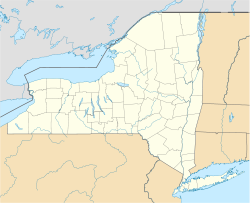

Coordinates: 40°57′45″N 73°7′49″W / 40.9625°N 73.13028°WCoordinates: 40°57′45″N 73°7′49″W / 40.9625°N 73.13028°W Country United States State New York County Suffolk Area - Total 2.2 sq mi (5.7 km2) - Land 2.1 sq mi (5.3 km2) - Water 0.1 sq mi (0.3 km2) Elevation 7 ft (2 m) Population (2000) - Total 947 - Density 459.1/sq mi (177.3/km2) Time zone Eastern (EST) (UTC-5) - Summer (DST) EDT (UTC-4) ZIP code 11733 Area code(s) 631 FIPS code 36-54617 GNIS feature ID 0959276 Old Field is a village of 918 residents (2010 Census)[1] in Suffolk County, New York, United States. The Incorporated Village of Old Field is in the town of Brookhaven, on the North Shore of Long Island. It is one of the most affluent communities in the state and is among the wealthiest towns in the United States. In 2010, Old Field was named the 25th most expensive town in the United States, with a median home sale price of $1,846,878 and a median household income of $185,398.[citation needed]
Contents
Geography
Old Field is located at 40°57′45″N 73°07′49″W / 40.962370°N 73.130318°W.[2]
According to the United States Census Bureau, the village has a total area of 2.2 square miles (5.7 km2), of which 2.1 square miles (5.4 km2) is land and 0.1 square miles (0.26 km2) is water.
Old Field Point Light is located on the northern tip of Old Field. The tidal estuary Flax Pond is another geographic feature of the village.
Demographics
As of the census[3] of 2000, there were 947 people, 313 households, and 268 families residing in the village. The population density was 459.1 people per square mile (177.5/km2). There were 346 housing units at an average density of 167.7 per sq mi (64.9/km2). The racial makeup of the village was 94.61% White, 0.74% African American, 0.11% Native American, 3.59% Asian, 0.42% from other races, and 0.53% from two or more races. Hispanic or Latino of any race were 2.32% of the population.
There were 313 households out of which 42.5% had children under the age of 18 living with them, 80.2% were married couples living together, 4.5% had a female householder with no husband present, and 14.1% were non-families. 10.5% of all households were made up of individuals and 4.8% had someone living alone who was 65 years of age or older. The average household size was 3.03 and the average family size was 3.23.
In the village, the population was spread out with 30.0% under the age of 18, 4.6% from 18 to 24, 20.9% from 25 to 44, 32.1% from 45 to 64, and 12.4% who were 65 years of age or older. The median age was 42 years. For every 100 females there were 98.9 males. For every 100 females age 18 and over, there were 98.5 males.
The median income for a household in the village was $165,398, and the median income for a family was $202,071. Males had a median income of $100,000 versus $33,594 for females. The per capita income for the village was $73,658. About 2.8% of families and 7.4% of the population were below the poverty line, including 9.5% of those under age 18 and none of those age 65 or over.
Government
The village headquarters of Old Field is located near the lighthouse at the end of Old Field Point. Administration of the village of Old Field and the community of Crane Neck (part of Old Field) is done at this headquarters. The current mayor of Old Field is Michael Levine.
Old Field Lighthouse


Old Field Lighthouse Located in the Incorporated Village of Old Field, The Old Field Lighthouse dates back to 1823. It was built by the United States Government for $2,500. The rest of the lighthouse was finished in 1824 for an additional $1,500.
The first light came from 9 whale oil lamps and was magnified by a large glass reflector.
In 1868, a second lighthouse was rebuilt, with kerosene lamps. In 1933, an automatic revolving light was installed. When the lighthouse was in use, the caretaker used the Old Field Village Hall as a home.
Today,[when?] the Old Field Constable and his family use the Old Field house.
The U.S. Government gave it back to Old Field in 1935, with the proviso that the government can take it back in case of a national emergency. It was taken back during World War II by the U.S. Coast Guard, but after the war they gave it back to the Old Field Community. The Old Field light shines on New York's Long Island Sound.
See also
References
- ^ "Old Field Village: 2010 Census". http://factfinder2.census.gov/faces/tableservices/jsf/pages/productview.xhtml?pid=DEC_10_DP_DPDP1&prodType=table.
- ^ "US Gazetteer files: 2010, 2000, and 1990". United States Census Bureau. 2011-02-12. http://www.census.gov/geo/www/gazetteer/gazette.html. Retrieved 2011-04-23.
- ^ "American FactFinder". United States Census Bureau. http://factfinder.census.gov. Retrieved 2008-01-31.
External links
Town of Brookhaven, New York County Villages Belle Terre · Bellport · Lake Grove · Mastic Beach · Old Field · Patchogue · Poquott · Port Jefferson · ShorehamHamlets Blue Point · Brookhaven · Calverton · Canaan Lake · Center Moriches · Centereach · Cherry Grove · Coram · Crystal Brook · Cupsogue Beach · Davis Park · East Moriches · East Patchogue · East Setauket · East Shoreham · Eastport · Farmingville · Fire Island Pines · Gordon Heights · Hagerman · Holbrook · Holtsville · Lake Ronkonkoma · Manorville · Mastic · Medford · Middle Island · Miller Place · Moriches · Mount Sinai · North Bellport · North Patchogue · Ocean Bay Park · Point O' Woods · Port Jefferson Station · Ridge · Rocky Point · Ronkonkoma · Selden · Setauket · Shirley · Sound Beach · South Haven · Stony Brook · Strongs Neck · Terryville · Upton · Wading River · Water Island · West Manor · YaphankIndian
reservationPoospatuckWebsite: brookhaven.org Categories:- Brookhaven, New York
- Villages in New York
- Long Island Sound
- Populated places in Suffolk County, New York


Wikimedia Foundation. 2010.